|
In the late 1700s, as the colonists in the East fought for independence from England, a small number of Europeans began to push back the wilderness on the western side of the Mississippi River near St. Louis. In 1769, Louis Blanchette settled along the Missouri River, establishing the settlement that would become St. Charles. Other families soon settled in the area, including Daniel Boone and his family along the Femme Osage Creek.
In 1803, Thomas Jefferson signed the Louisiana Purchase, and these settlements officially joined the young country. The following year, Meriwether Lewis and William Clark led the expedition that began the formal exploration of the area west of the Mississippi River.
In 1805, Daniel Boone’s sons, Nathan Boone and his brother Daniel Morgan Boone, seized on Nathan’s recent discovery of a salt lick more than 100 miles west on Salt Creek in Howard County. The salt lick, named such because of the deer and other animals that came to lick the salt, was a great find. By boiling down gallons of this salty water, the Boones could extract salt used for preserving meat and other tasks.
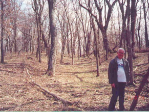
They soon established a sizable extraction operation at this site, hauling the salt out by boat. The route they traveled to the lick started as a Native American trace, however, as travel increased it grew to be a trail across Eastern Missouri. During this time, they began to describe the bounteous country surrounding the Boone’s Lick, which looked much like the land around Lexington, Kentucky. Their stories stirred migration fever in the most intrepid settlers.
Additional settlements spread along the north bank of the Missouri River, although the continued threat of Indian attacks kept most pioneers from settling in the area. Boats hauled some goods into the area, but the overland route continued to develop north of the river where the topography was more forgiving.
As the War of 1812 ended and hostilities between the white settlers and Indians diminished, a great pent-up demand was unleashed for land west of the Mississippi River. The trail that Nathan and Daniel Boone had cut in the early 1800s plunged to the heart of the fertile land near the salt lick. The pioneers called this area Boonslick, and it captured their imaginations.
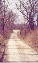
Almost overnight, the town of Franklin appeared (1816) and boomed along the northern edge of the Missouri River a bit south of Boone’s Salt Lick. The route that had been gradually extending westward with limited traffic suddenly had to handle thousands moving west with their wagons, families, and livestock. What for a short time may have been best described as a “trail,” by necessity was now a “road.”
Additional settlements were filling in the gaps in places like Camp Branch (present western Warren County) and as far west as Fruits (present Williamsburg in Callaway County). Stage routes were established for mail service and passenger travel.
In August 1821, the United States welcomed Missouri as the 24th state in the Union. The early territorial counties were divided into many new ones. The Boone’s Lick Road crossed six of these counties: St. Charles, Warren, Montgomery, Callaway, Boone, and Howard.
In September of that year, William Becknell outfitted a caravan in Franklin and headed southwest to Santa Fe, where his trade goods were welcomed. His return to Franklin marked the opening of the Santa Fe Trail. The Boone’s Lick Road, now generally considered as having ended in Franklin, was even busier than before.
The establishment of new counties also meant new county seats. In Boone, the trail did not travel through the county seat. The founding fathers could not allow this situation to persist and decided that Williamsburg, in Callaway County, was the ideal spot for a southern branch of the Boone’s Lick Road to begin. A new road leading slightly southwest from Williamsburg was built and gradually drew more traffic from the original. When Fulton became the county seat of Callaway, another variation was created. Soon, these newer routes dominated and the original branch became a local route.
The early trails that formed the Boone’s Lick Road continued to grow and evolve to meet the changing needs of the communities they served. Sections of the road foreshadowed the National Road and Interstate 70 in the centuries that followed.
|
Early Quotes from the Road
Set out from St. Charles, at half past 11 oClock a.m. and proceeded on, passed Several branches of the Dardan Creek a branch of the Mississippi, through a Butifull high rolling Country intersperced with plains of high grass Most of them rich & fertile, and encamped at a Pond at the out Skirts of the Settlement in a butifull Plain, near a few low trees. had a Camp guard of 1st. 2d & 16 privates Many of the Citizens visit us this evening 21 miles.
~ Journal of William Clark,
August 25, 1808 written during
his expedition to build Fort Osage
During the first, second, and third years of my residence here, the whole current of immigration set towards this country, Boon’s Lick.... Boon’s Lick was the common centre of hopes, and the common point of union for the people. Ask one of them whither he was moving, and the answer was, ‘To Boon’s Lick, to be sure.‘
~ Timothy Flint, 1826
The tinkling of bells, the cloud of dust, the throngs of hogs and cattle, the white headed children, the curly headed Africans, smiling infancy, blooming virgins, athletic manhood and decrepit age, altogether form groups too interesting to be painted by the pencil of Teniers.
~ St. Louis Missouri Gazette,
June 9, 1819
Immense numbers of wagons, carriages, carts, etc. with families, have for some time past been daily arriving. During the month of October it is stated that no less than 271 wagons, four-wheeled carriages and 55 two-wheeled carriages and carts passed near St. Charles, bound principally for Boon’s Lick.
~ Franklin Missouri Intelligencer,
November 19, 1819
|